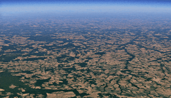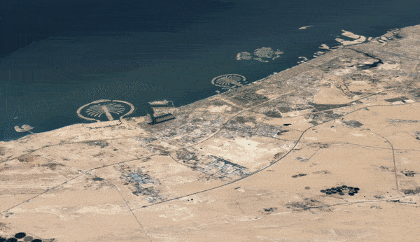
Google Earth has just released its biggest update in four years, launching a new time-lapse feature that lets users gaze at Earth satellites over the past 37 years. Within this relatively small space of time, the satellite images reveal some startling changes to the natural environment, from retreating Alaskan glaciers to devastating deforestation.
Google Earth was first released almost 20 years ago as a program that displays a 3D representation of Earth based on satellite imagery. Over the years, it’s become increasingly better quality, and now covers over 98 percent of the planet’s population.
The new update adds time into the equation, enabling users to journey through a satellite’s view of Earth in recent decades using over 24 million satellite photos from the past 37 years. That’s an incredible amount of data: some 20 petabytes (or 20 million gigabytes). To compile this data into a single 4.4 terapixel-sized video mosaic, it than two million processing hours across thousands of machines in Google Cloud
"As far as we know, Timelapse in Google Earth is the largest video on the planet, of our planet," Google said in a blog post.
On top of this, Google has uploaded more than 800 timelapse videos in both 2D and 3D at g.co/TimelapseVideos. The videos can be downloaded by anyone and Google is encouraging governments, researchers, teachers, and advocates to freely use the images to highlight the plight of our planet.
“Timelapse in Google Earth is about zooming out to assess the health and well-being of our only home, and is a tool that can educate and inspire action. Visual evidence can cut to the core of the debate in a way that words cannot and communicate complex issues to everyone,” Google added.
Anyway, that's enough chattering for now. Sit back and enjoy some of this stunning (and shocking) satellite imagery of our swiftly changing world. Users can easily access the “Timelapse” Google Earth tool simply on a web browser, which comes ready with five thematic stories focusing on how our planet has changed in the past four decades, from rapid urbanization to sifting river flows of the Amazon.